Rico Live!
lt.flymaster.net/bs.php?grp=3376&pwd=6bacb0cf13ae612207a40fb67b12be
lt.flymaster.net/bs.php?grp=3376&pwd=6bacb0cf13ae612207a40fb67b12be
I meet Marko for coffee and a thorough briefing. He is competing in the serial cup. Later I walk to Camp Gabrije where Sergei welcomes me and offers me a ride up to launch.
I arrive on Kobala’s launch, just in time for the competition’s briefing. At present the wind is still quite strong from the East, Bora is what I think they call it. It’s expected to ease up later in the day.
A few pilots are in the air. One apparently flies into a rotor behind a ridge, has a collapse and autorotates down and out of sight. No reserve. That’s how fast you can bust your back. Soon enough, the pilot is on the phone with the race organizer. He’s unharmed. They call mountain rescue to help him.
I’m antsy. The thought of flying over stretches of unlandable terrain gets to me, as does the accident.
The window opens and a hundred pilots launch. They gather up high for an air start. The day is definitely on and the Bora has subsided. I suit up to what might be the last launch of this trip.
In the air, an unbelievably smooth 4m/s thermal lifts me up to cloud base. I point both towards the main mountain ridge. Away from civilization and away from landable meadows.
When I reach the summit, it’s tougher than I expect to get back up to cloud base. I start following the ridge East, further into the abyss. There’s a SSW wind helping me, but it’s more than 16 km/h strong. I don’t want to know how the wind in these tight valleys is. Nerves aside: the landscape is beautiful.
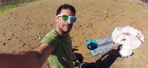
Eventually I make it to Sorica and know I’ll make it through. Soon I start hitting controlled airspaces and head south until I’m low enough to sink below them. I glide super low through a valley out of the mountains and towards Skofia Loka. Here the journey ends, and Ljubljana international airport’s CTR begins.
One last thermal to enjoy and feel thankful. Then land and pack. I catch a bus to Kranj and buy a train ticket home.
I’m really sore today, the long march to Bovec got to me. The weather is great for walking, terrible for flying: windy, cloudy enough, not raining. I hike from Kobarid to Tolmin. It’s only three hours or so, but my pack feels heavy and my legs ache. Not to mention my shoulders.
Tomorrow the weather should be flyable. The Paragliding Slovenia SerialCup will be on, and I’m looking forward to some action on Kobala launch. After watching the comp, I’ll give it a shot myself. I spoke with Marko, a local I met in Brazil, who gave me some pointers on the way East:
“Cloud base will not be so good tomorrow and wait until afternoon when NE wind stops. Later in the day light SW wind should come and you have chances to made it to Železniki.
And one thing - between Koritnica and Sorica there are no landings down in the valley.” Also, Marko points out the limit, where you would run into controlled airspace of Ljubljana international airport.
Recovering from yesterday’s long haul I enjoyed breakfast at the Thirsty River Brewery. After catching up on my correspondences, I met up with Tamara & Nico for lunch.
Initially, I had written off flying today, but the weather started clearing up at noon. And how strong could the wind really be?
We took the gondola up to Kanin. Out definitely looked flyable! Nico and I launched and thermalled up to cloud base. We then set our sights on Polovnik. During the transition we started to feel wind.
Following that ridge forward against the wind was rather unpleasant, but I did manage to gain enough altitude to glide out over Ozben into the larger valley. That’s when the wind became impossibly strong. Pushing speed bar without making headway, I decided I’d had enough. Went in for a windy landing and walked back to Kobarid.
After a hearty breakfast at the Feistritzer Schutzhütte, I hike up to Oisternig. I’m joined by Robert, a local on a hike & fly mission of his own. He gives me a comprehensive briefing on region.
There’s a thick inversion all around us, but the wind is good. Robert launches & stinks out. I decide to wait.
When I do launch, I try to core some thermals but can’t make any meaningful height. Against the SW I glide painfully low out of the unlandable, forested slopes. Still, compared to what I’ll see later in the day, this is a piece of cake.
The valley wind is already pretty stiff as I land in Camporosso. I give Robert a call, he encourages me to catch a gondola up Monte Lussari. From there I thermal up over Monte Cacciatore. Unfortunately not much higher. The SW is blowing, and this doesn’t look like enough to penetrate to the south side of the Bredil pass. I try anyway.
Even before I sink below the ridge of the pass, I can see the gust ripples on the lake. Windsurfers are ripping it. This is completely nuts. I give up and, with my tail between my legs, land in very unpleasant conditions. I’m pitching wildly, often losing brake pressure (if you’re not a pilot: this feels like walking on a frozen pond and suddenly one foot blows through the ice). Once more, I am amazed at how well the Zeno takes it.
As I’m hiking up towards the pass, I see a path straight up to the the mountains on my left. Can I bust a Superman-move into Slovenia? Up I go.
As I reach the gap to the other side, my courage leaves me: I don’t want to fly in this wind. And the terrain freaks me out. I decide to walk. Yearning for a shower, it becomes a long hike to Bovec by the time I find what I’m looking for.
I started walking before nine. Almost 20 km from Hermagor to Vorderberg. And then 1500 m up the mountain.
By the time I reached Oisternig summit, the wind was too strong to consider launching, and I was wasted.
Though tomorrow’s not looking great, I’ll catch some rest and try then.
From the moment I landed at Eggershof, I got smothered in a wonderful bath of hospitality and friendliness. After a hearty breakfast, Beate, my host, gave me a ride up towards their Almhütte. She was heading up to turn the hay, and took me a bit further.
After 40 minutes walk I then reached Grifitzerbühel. The day still being early, I decided to hike up higher to Lumkofel, super steep. Not that I expected the extra height to make any difference. The forecast announced a massive Inversion blocking all low thermals.
Before launching, I had a chat with my friend Nico. Over in Slovenia, he felt the day would be grand.
The wind was pushing from the north. Difficult, since Lumkofel’s slopes face south. I tried to launch and failed at first. After some repositioning, I managed to hurl myself out the leeward side.
Inspired by Nico’s optimism, I gave luck a chance and got rewarded by nearly two hours flying. Eventually I bombed out in Glitschtal and hiked to Hermagor.
https://www.xcontest.org/world/en/flights/detail:rchandra/20.8.2020/10:00
I’m making headway. Flying was not pleasant today. Better than walking? All the while.
After consulting with my buddy Nico, I trotted over to Trens and hiked up to a launch. The wind was fine, but I felt I’m too low, only 400 m above the valley. I felt my motivation shouldn’t be exposed to the risk of gliding down to where I started... I hiked higher.
It took me by whole to find a launchable spot. My arithmetic: I’m not willing to risk a 5% probability of landing in a tree on this launch.
I launch and the day is on. I’m late to the game but happy to have gotten my 6&1/2 hours of sleep. More than 4 m/s lift at moments, up to 3500 m asl. 5.5 m/s sink too, but not for extended periods. I blast over into Pustertal.
The flying is hard work. There’s a hefty NW and I’m getting pummeled. “Type II” fun, Gavin would call it.
I leave Pustertal for Gailtal, but get shaded out. I sink into valley wind. I don’t get beyond the farm I land on. They serve me for dinner (pumpkin soup from the farm, home baked carynthian bread with salami from their own cows, cole slaw, beer), and offer me a place to stay. We have a delightful evening. Gotta love Austria.
https://www.xcontest.org/world/en/flights/detail:rchandra/19.8.2020/11:57
I get up early and check the weather. It was supposed to be flyable but isn’t.
A friendly shepherd takes me up to Timmelsjoch. 600 sheep in his care. Cloudbase is below the pass height, it’s cold, and it’s blowing across the pass to the south. 5 hPa pressure gradient, not 3 hPa as the forecast originally assumed.
It is frustrating to walk down from 2500 m asl. That said, the weather isn’t making it a close call.
In the afternoon the rain avatars and the sun comes out. I hike up a west flank. Rather uneasy about flying under the circumstances, I launch. I get up to cloud base without much trouble. Heading East, I dodge clouds to enter my valley of choice- it has landing opportunities, unlike some of the narrower ones. As I approach the Wipp valley that leads north to the Brenner pass, I face very strong headwinds. I decide against flying into the main valley to land, fearing the Föhn.
Finding a hotel is the next challenge. I really want to wash my clothes, shower and shave. Everything is booked out. The tenth place I try has a last room left. I take it. The clerk, realizing I haven’t had dinner yet, and seeing I’m by foot, generously offered me her bike to get to the old town for dinner. No locks here, “just leave it behind this tree when you’re done”.
Schönjoch sits at 2400 m asl above the massive Austrian ski resort of Fiss-Serfaus. I take the cable car up to get ready for an early start. Hefty thunderstorms have been forecast for the early afternoon.
I launch and easily make some height, but not much. I make a go towards the East nonetheless. The Inn -the valley I’ve been following all day yesterday- loops northeast to Landeck and only then turns back East. Not a detour I feel like making. There is a valley heading due East, but I don’t have the height to comfortably cross and reconnect with it. I try nonetheless.
Arriving low, there is some lift, but not enough for my patience. I violate one sacred rules, “when you’re low, never leave lift to search for lift”. I pay the price and decide to slope land and hike up what’s missing. What takes 10 minutes in a weak thermal can be hiked in an hour. Lose another 25 minutes packing and unpacking.
Once high enough -I wish I knew the definition of “enough” in this case- I unpack on a classic line-snagger slope covered in low brush. I hurry to get back in the air. Now the thermals are cranking. I follow the ridge west and eventually cross towards Wildgrat. I’m flying at 3000 and wearing nothing on my legs except board shorts on my legs that I try to keep tucked away in my harness’s wind skirt.
I enter Ötztal high. The flying is spicy, the atmosphere brimming with energy ready to explode.
About 20 km up the valley, the Ötztal narrows, sandwiched between mountains 3500 m high. Landing opportunities become scarce, and I expect there’s a nasty strong wind down there.
Over Sölden the first rain drops hit me. Time to get down, fast. Lift everywhere I go. With big ears (a maneuver to sink more) I push the speed bar all the way. I see a generous patch of landable green in Zwieselstein and spiral down. I realize this is a terrible place to land, with a fight between powerful gusts of valley wind, a southerly wind pouring across the pass in the opposing direction, and thermal bubbles sniping left and right. I’m amazed at how well the Zeno handles. I land safely. Tomorrow I’ll take a break.
Yesterday I called Simon and Pescha, to seek local guidance from guys who know the Oberengadin well. The launch I’m aiming for - Muntischè - will be exposed to the north-westerly pouring over the pass. They advise me to give it a try, but have the Plan B ready to walk up the other side of the valley if things become to rough. Simon also warns me to fly fast as he’ll be on my tail [no exaggeration, he did indeed fly from Fiesch to Oberengadin that day].
I’m accompanied by Michèle on my hike from Albula pass to Muntischè. The NW-wind across the pass is picking up, but there still are strong thermals coming up from the valley. By the time I’m ready to launch, the NW is pouring over from behind. I don’t usually cuss and swear, but felt this might be a good occasion to practice.
Admitting defeat, I heave my wing over the knoll and prepare to launch to the NW, into the wind. In the air I loop round to the south east, into the rotor created by the launch. I get pounded, but manage to core a moderately healthy thermal up to cloud base at 3300 m asl. I blast off down the valley.
Anticipating Flüela pass to be spewing out even more wind, I cross gingerly, following the highest peaks. And beautiful views. In the Unterengadin, at Piz Linard, the going gets tougher. At Scuol, I see gliders not getting above take off height. Cloud base seems to be coming down too.
I reach the border to Austria, already well within the reaches of the mighty valley wind. I push forwards past Pfunds, but don’t have the fight in me to fly further. I walk the rest of the way to Tösens.
It was raining all morning. I used that to catch up on work - with a number of telephone conferences. Kind of surreal sitting on a bed in a hotel room in the mountains, wearing board shorts and a merino T-shirt discussing matters of nuclear security.
Once the rain eased, I started hiking up Muot - the Mountain facing Bergün. From there I launched into what would be a sled ride up to the valley towards the pass. After I finish packing, the sun did peek out. I figure’d I’d make the best of the rest of the day hiking a bit further up the pass. It was worth it for the beauty alone.
There’s something about not knowing where or how your day will end. Will it be in a hotel room? Or alone outdoors? Will be in a hospital? And there’s something disconcerting about knowing that between now and the end of the day you’ll be doing something you’re afraid of. Most of my life, when things go sour, I pull the plug, go home, go to sleep and the next day will be better.
This trip is teaching me that comfort isn’t something available externally. Rather, I’m learning to find it inside myself. Walking up to a gnarly launch, feeling anxious about the sketchy conditions I comfort myself, knowing the decision is mine alone whether I will launch or not. As such, there is no danger as long as I don’t make stupid decisions. It’s also me who decides whether I’ve had a good day or a bad day. After all, when I find myself in some ordeal and feel sorry for myself, isn’t that what I had wanted with this trip? I never assumed this adventure would be possible without episodes of suffering and hardship. At any given moment I could be at home watching TV on the couch. I decided against that, so who’s to say I’m having a bad day except myself.?
That said... today was a good day. It needn’t have been. I woke up to the sound of the wind howling. It was wet outside. I treated myself to a short but delightful breakfast and hiked up a mountain, although the sky was looking black in places and the wind was slamming in from the south. When I reached the summit, I was fairly sure I wasn’t going to launch then and there. Too much wind from the wrong direction, scary directions at that. I put my pack down and waited. I am a slow thinker but I usually arrive at the right decisions. After a while I started preparing my gear to launch.
Here is the calculation I made: I know I can get off the ground. Despite the crosswind gusts. The problem will arise when I loop around to the north side, to the lee of this ridge. There will be a massive rotor; plenty of turbulence spiced up by the charged atmosphere that will result in storms later today. I consult the wind stations surrounding me: although from the wrong direction, none of them read above 40 km/h. Finally, I can enter the danger zone with almost 300 m between me and the terrain, which seems enough cushion should things go flaky. I launch and try coring a couple of thermals. I managed to make some altitude before losing my nerves.
I glide out into the valley and get some lift on the opposing slopes. Through the hot soup of the valley I land gently near Filisur. I pack up and start hiking in the direction of Albula pass as storms brew above me.
SAC cabins are special. Mind boggling that our tribe has been building these works of art in the most inhospitable spots our country offers. The Albert-Heim-Hütte is a gem, staffed by an awesome team.
The hut sits on a spur, looking out over what’s left of the Tiefen glacier. I follow the spur to its highest point, Schafberg.
I launch and core a thermal to above 3000 m. Pushed by a gentle southwesterly I fly across Andermatt, the Oberalp pass, down the Surselva to Crap Sogn Gion. Keen to avoid the dark clouds above Calanda, I cross the valley to the south. I’m dodging the clouds that tower threateningly high. In Thusis the ride ends: south wind is blowing in, truncating thermals.
I land in a furnace. After having spent the last week at altitude, my brain overheats. I flee up to Obermutten, 2000 m up. Yet there are storms in three directions, and the wind is sketchy. I decide to spend the night.
They’ve forecast thunderstorms as of noon. I get up to Moosfluh- above Riederalp- early. At 10:30 not a single glider is on the air. Strange, we’re in the Mekka of free flying. I launch. Right into a gentle morning thermal.
As I arrive above Fiesch, others launch, only to scratch the forests low down. Sluggish start.
A good hour later, clouds are towering into the sky. Not long until it gets unflyable. I cross Grimsel, and as I’m over the Rhône glacier it becomes clear: I need to land soon to avoid the weather. I fly to Furka pass and nearly get ready rained on. Spiral down and land.
I hike to Albert-Heim-Hütte, a jewel of a cabin the Swiss alpine club (SAC) has to offer. A hearty dinner, followed by drinks and watching shooting stars with the other guests and team.
I spend the day washing clothes, eating, recharging , and catching up on my blog. In my video of today, I’ll review the instruments I’m carrying with me.
Tomorrow I’ll be pushing East again, despite forecast thundershowers. And my live tracking device will be recharged and transmitting.
The flight yesterday felt good; I feel reinvigorated. The glory of leading the serial class ranking was short lasting. Meanwhile, Philippe, who I flew with in Brazil, has scored an amazing 230 km FAI triangle, earning him a well deserved 20-point lead.
Weather predictions. Even after 27 years of flying I’m still a sucker for good forecast. And the forecast for Fiesch was looking very good, so I could not resist jumping west for a change to try to get in some points.
You see, we have this online contest. Pilots from around the world upload their xc (cross country) flights, the furthest 6 count. Through lucky circumstances, I am leading that ranking for the serial class (i.e., on serial gliders, no comp wings). Better put: I was leading that ranking until last week. Today I have the chance to correct that.
I meet up with Reynald and Sebi, two of the world’s best xc pilots- who happen to be my team mates in Alpsfreeride. We launch from Moosfluh, above Fiesch.
The north wind is clearly noticeable, and the day is slow to turn on. I embark on a massive triangle, flying as far in each direction as I dare. I take the high route over the Aletsch glacier, far from landable civilization. The Swiss Paragliding Open is happening right now in Fiesch and I see them fly, an impressive tight cloud of 130 of the nation’s best pilots charging wingtip to wingtip across the Aletsch.
In the lower part of the Valais, I get washed down by the north wind pouring in from the north. I recover and push on.
The last leg leads through the scary southern valleys of Zermatt and Saas. Scary, because sandwiched between Switzerland’s highest peaks. Scary when thermals slam into your wing in a dizzying climbing frenzy up to 4500 m asl. Scary because of the strong winds. I nearly bury myself deep in the Saas valley. With luck I can extract myself, dial back up to 4000, and glide back to where I started.
190 km, 300 points. That’ll do. I’m leading the ranking for another day: https://www.xcontest.org/world/en/ranking-pg-serial/
I wake up, lay out my tent in the sun to dry off the moisture. Not sure what to make of Slovenia COVID-blacklisting Switzerland. Stick to my goal? Change plans? I pack up my gear & get going. One last check that I didn’t forget anything? Let it be, don’t have anything to forget.
I hike up to Crap Sogn Gion. In the summit restaurant I grab a sandwich and charge batteries for a while.
At the launch, I lay out my tent to dry. I wonder where I left the tent pole? How useless is a tent without its poles. Let’s not dwell on that.
The wind on takeoff is shifty. A rigid wing starts its takeoff run. “Not looking good”, I think as his wingtip catches on the steep slope. The glider violently yaws sideways. A brief, rasping noise as expensive pieces of kit break off. A half dozen pilots run to help. The pilot seems ok. In a group effort, what’s left of his glider is carried up the slope. Wounded dragon.
I launch and core a spicy thermal amongst other glider and the obstacle posed by the cable car. I point my nose west.
Why west? Every veteran pilot I asked advised me to not try to cross the valley to head south directly, but to at least do head west an hour before trying - thereby reducing the risk of sinking into the stability and getting gobbled up by nasty valley winds. Going east doesn’t look promising either, considering headwinds and terrain.
The going is good. I’m heading west at quite a clip. And high: 3500 m asl. I don’t feel like turning around to head south and then east. Besides, if Slovenia is off the menu (COVID quarantine?), I have more time. I decide to follow the flow westwards. The weather forecast for tomorrow in Fiesch is really good, and I feel deprived of good flying. Why not take a break from hiking? I will throw in a day or two of pure xc distance flying, solve the tent pole issue, and figure out what to do with Slovenia.
There are two mountain passes between me and Fiesch. These are fairly unflyable in strong northerly conditions. I decide to try. I approach Oberalp pass high and proud. An easy glide I think. Until the north wind slams into me. My sink alarm goes off and I’m losing altitude at 4.3 meters per second. I point my nose south and push my speed bar, trying to outrun the lee. But I’m getting tossed around like a rag doll. For a few moments I feel it doesn’t make a difference in which direction my nose is pointing.
I reach the opposing slope and the sink turns to zero. The air has to go somewhere, it can’t just drill through the opposing mountain flank. It remains super turbulent. I cross to Gemsstock, and manage to find some usable lift. But it’s not reaching high enough to get out of the stability. Also, the rodeo I just experienced has dissolved my desire for more of the same at the even nastier Grimsel pass. I land in Realp, coming down nearly vertically in the wind.
From here there’s a train that goes directly into a tunnel, to reappear near Fiesch. I take it.
From Elm I hike up to Segnes Pass, at 2600 m asl. The first 500 m there’s a cable car, the rest is a grueling hike. When I finally arrive at the top, the north wind is howling. Wrong direction.
I hike down the other side, figuring eventually the north wind would be blocked by thermal unwinds, enabling a launch. Three hours later I’m still walking. The incredibly beautiful landscapes almost compensate the torture of carrying my glider down the mountain.
I get dinner in a mountain hut, stocking up on water and battery charge. I continue walking until after sunset, pitch my tent, pop a sleeping aid and get some rest.
I get a text message from my friend Beat, “Rico, I know it’s a battle and unbelievable, but there’s an inversion. Sailplane pilots saying bad day for flying.” An inversion means the atmosphere is too stable for thermals to carry me upwards. I mentally prepare myself for a day of “sled rides”, just gliding down from launch.
Yesterday, I flew into the ski resort of Hoch-Ybrig. I’m fond of this place. When I was 14, I spent a week in ski camp here. Twelve years later, my best friend Dominic and I finally succeeded in our autodidactic quest to learn the SAT maneuver - an effort that could easily have ended in carnage.
If you’re wondering about the erratic line I’m following, check the DABS (Daily Airspace Bulletin Switzerland): The Swiss Army had cordoned off the valley next door for shooting practice. There are more elegant ways to make the news.
Today’s the last day I’ll enjoy the wonderful company of Michèle, who’s joined me on the last few days’ hikes. The wind is northerly, I’m anxious to find a launch that’ll allow me to fly into the south side of this ridge. Together we clamber up Forstberg (2215 m asl). the wind and the short steep slope align - kind of - before the sheer cliff drop.
Launching works out fine, and I’m gliding along the sun drenched cliffs above Muotathal. To my delight, I cam core the occasional thermal as long as I stay above the inversion. Above the lake of Klöntal - sandwiched between steep mountains and no place to land low - I land high on an alpine pasture and hike for an hour before launching out again, gaining sufficient ground in thermals to jump across the Linth valley of Glarus. I soar up the unpleasantly turbulent valley west face as much as I can before gunning downwind into the tight, windy lee of the Sernf valley, leading to the ski resort Elm.
Impressive, the monastery of Einsiedeln. I hike round it and over the back. Headed for Hummel, a popular site for soaring, with an unreliable lower launch, as well as a “your sweat earned you” upper launch. There’s more than 5 hPa pressure gradient north to south (pilot speak for “plenty of north wind”), so I unpack on the lower launch.
Despite hefty gusts, not enough to get established. I slope land, pack up, and hike all the way to the upper launch.
The wind’s shifty up there with punchy gusts, and I have absolutely no inclination of walking back down. I launch, thermal up to the miserably low cloud base, and point my nose downwind. Next ridge gives a decent amount of lift before I jump into the lee (down wind of an obstacle you get turbulence. Especially today). In a nasty rodeo ride I skim the valley floor thinking, “goodness, I wouldn’t hang my laundry out to dry in this wind, it’ll blow over the next ridge”. On the far side, as the wind hits the bend in the valley I catch some lift. And then more and then more. Pity it’s overcast, it’s still early. Aw well, leave some for tomorrow.
The rain started to ease towards noon. With the wind shifting to North East I gave up my hopes for the west oriented launch of Zugerberg and headed for the east oriented launch of Ramenegg; about a three hour hike away. On arrival we ducked into a tiny alpine hut for a simple lunch just as a rain shower passed over us.
I later launched to glide over to the next hill and walked over it. No launching from there. Adventurous hike through the thickets to eventually reach Einsiedeln - a place of pilgrimage with a huge cathedral dating back to the 10th century.
Sunshine and difficult flying conditions announced for tomorrow!
Not a big fan of rain. It should stop sometime tomorrow though. I’ll get moving again once it does. Judging by the forecast, the wind will swing around to northeast during the course of tomorrow. And sunshine as of day after.
Fairly certain tomorrow will begin with a hike to be able to eventually launch towards the east.
I’ve got great company here in Zug. As good a place as any to catch up on sleep, good food & wine, and possibly a movie tonight. Oh, and that haircut I wasn’t able to get before leaving. There go another 50 grams. I look like an adolescent with a buzz cut.
Some frustrations mounting...
Got off to an early start in Sihlbrugg. I skipped breakfast, figured with bad weather approaching I’d make some progress early and have plenty of time to catch up on food when the rain arrives.
The hike over to Zugerberg was long, my pack felt heavier than yesterday, and my body aching.
I arrived on Zugerberg launch- our home spot- to an overcast sky. Waiting for some rays of sun to puncture the cloud cover I ate a tasteless breakfast of a Powerbar (allegedly “cookies & cream”) and two nut bars (the salty ones they sell at the gas station, the chocolate getting all over my hands).
The sun came out, I launched, the sun disappeared, I landed.
It was so hot & humid my iPhone refused to work. Annoyed, I took the cable car back up. Back up at launch the horizon was dark from the cold front about to roll in. I launched, wingovered down, and found a hotel to hunker down until sunnier days come.
Late start, had to first get back to Zurich from a party in Basel. It would likely have been an even later start had the police not arrived to shut off the sound.
I had wanted to get my hair cut before leaving - not just to save weight. Only realized too late that August 1 is a national holiday and most barber shops aren’t open. So much for that.
To get outside the city limits I took an e-scooter. Started hiking in loaded skies with occasional rain. Zurich doesn’t have much in the way of flyable mountains- too flat, too close to ZRH airport. Trying to get closer to the mountains, I hiked the length of the Albis ridge to Sihlbrugg.
I was tempted to fly down from the ridge towards Hausen, but decided to respect the airspace around the local airfield.
Great dinner in a Michelin class restaurant. Weather looking lousy the next two days, good thereafter.
I’ve spent the last few weeks weighing clothing and figuring out what to take. Below is the list of what made the cut. A bit more than 18 kg, not including food, and not including water.
Total Equipment Weight….…....….18 kg
Flying gear..……………………………….……….10’583 g
*Line-cutter, whistle, leatherman, dental floss, wound seal, rip-stop, lines, superglue, sunblock, needle & thread
Instruments..……………………………….………….1’149 g
**iphone cable, nano usb cable with usb-c adaptor, headphones & thunderbolt adaptor, double usb charger, paper notebook & pen
Hiking gear..……………………………….………………….2’560 g
***30 sets of contacts, deodorant, toothpaste, toothbrush, bug spray, anti-itch, lighter, soap leaves, toilet paper, ear plugs, eyeglasses, bandage, tape, disinfectant, paracetamol, sleeping aids, water purifier drops, personal meds, face mask, house key, credit card, drivers license, ID
Outer clothing..……………………………….……….………….2’756 g
Inner clothing..……………………………….………………….940 g
Wenn auch kein Profi, so ist Rico kein Unbekannter. Vor mehr als zehn Jahren hat er bei paraworld.ch einen Vortrag über seine Gleitschirm Himalayaexpedition gehalten. Er fliegt seit 28 Jahren unfallfrei. Zur Zeit dieses Schreibens führt Rico die Serienwertung im XContest: https://www.xcontest.org/world/en/pilots/detail:rchandra
Wir begleiten Rico Chandra bei den Vorbereitungen für sein Abenteuer, das wir im August dann auch per Livetracking und Blog mitverfolgen Können. Was nimmt er mit?
Wie schwer kann das wohl sein, nur mit dem Gleitschirm zu reisen? Rico Chandra will’s wissen und probiert es für uns aus. «Wir wollen schliesslich auch dieses Feld nicht ganz den Profis überlassen,» meint er mit einem schelmischen Lachen. Wir haben ein paar Worte mit ihm über die Vorbereitung seiner Augustreise gesprochen.
Abschiedsbier: Donnerstag 30. Juli, bei paraworld.ch in Zürich
Reisestart: 1. August, 2020
Ziel: Ljubljana
Rico wird unterwegs auf Instagram bloggen. Folgt ihm auf @ricoforthelost
Um den Druck auf ihn zu erhöhen, werden wir ihn live-tracken. Mehr dazu auf Instagram
